La Maplouine LaMaplouine The ultimate Saint-Malo tour guide FR

The interactive heritage map of Saint-Malo: malouinieres, forts, islands and history.

More than 950 geolocated notes in Saint-Malo, along the Rance and across the Clos-Poulet, each carrying something you did not know. Scholarly and playful, La Maplouine is the interactive map for explorers who want to know the corsair city beyond the received ideas. It runs in Google Maps, so it is easy and practical to use.

The only interactive map of the heritage and history of Saint-Malo. Regular updates included, no account to create and no app to install.

950 +

notes, from the walled town to the upper Rance and the Dol marsh

10

categories: manors, churches, forts, islands, mills, streets…

2

languages, the whole map in French and in English

Four notes, in full

990 geolocated notes on the heritage of Saint-Malo, the Rance and the Clos-Poulet.


Intra-Muros

Piscine de Bon-Secours

A sea pool built against the Bon-Secours strand in 1936, closed by a concrete wall and fitted with a diving board. Pools like it belong to coasts where the tide falls a long way. The wall keeps the water in as the sea withdraws, so the basin stays full through the hours the beach lies dry, and every high tide renews it. Bon-Secours came with the 1930s wave of bathing works, at the same time as the cutting of the poterne d'Estrées, when the walled town was finishing the conversion of its military foreshore into a bathing front.

📍 48.6486, −2.0303
Forts et îles

Le Pouilloux

A reef that dries off the grève de Bon-Secours, between the foot of the ramparts and the Grand Bé. It belongs to the string of rocks that long left the Saint-Malo anchorage open only to those who knew the way through — an advantage in defence the town was careful to keep, and the pilots of Saint-Malo were a closed trade. At low water it stands clear of a foreshore of sand and rock that can be walked out to the islets; at high water it goes under completely.

📍 48.6491, −2.0301

Paramé

Manoir de la Grande Barbinais

A manor on the Château-Malo road, later given over to farming and coarsened by the extra storey put on under the French Empire. The land belonged to the Porcon family, and one Porcon is still remembered here as the Malouin Regulus. The story runs that Pierre Porcon de la Barbinais, a captive of the Dey of Algiers, was sent to Louis XIV with terms of peace, chose to return to his chains rather than break his word, and was beheaded for it in 1681. No seventeenth-century text mentions it: the tale first appears in Manet in 1824, and historians take it for a pious invention. The one La Barbinais on record for such an errand is Luc Trouin, elder brother of Duguay-Trouin, a slave in Morocco, sent in 1689 to negotiate an exchange of captives; his mission succeeded. An octagonal cross stands not far away, carrying a stiff-limbed Christ. La Petite Barbinais, next door, belonged to the manor outright.

📍 48.6455, −1.9611

Vallée de la Rance

Ancien camp viking de Saint-Suliac

An earth rampart cutting off a spur above the Rance. Local tradition puts it down to the Northmen raiding in the ninth century, but the case is thin: enclosures of this kind were already common in Armorica in the iron age, and nothing datable points to Scandinavian occupation. The name Viking camp owes more to storytelling than to archaeology. That takes nothing from the work itself — a bank and a ditch thrown across a headland, a defence of formidable simplicity.

📍 48.5549, −1.9669

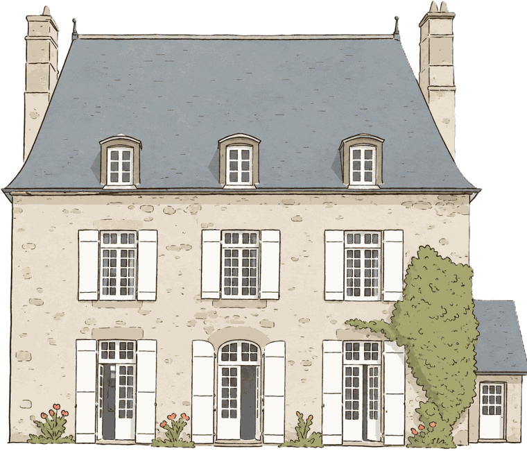
Une malouinière : corps de logis en moellon sous un toit à croupes d'ardoise, trois lucarnes, hautes souches de cheminée
The malouinière: the shipowners' house in the country — one block under a hipped roof, dormers in line, a walled garden. The map carries ninety-one of them.

Try before you buy

Fifty places, free, right now.


Five places in each of the ten categories, taken from thirteen different areas, so you see the range rather than one corner of it: ramparts and churches, of course, but also a brickworks, a Viking camp, the Rochefort beacon, a reef that vanishes at high water.

Les lieux de La Maplouine, de la ville close à la haute Rance
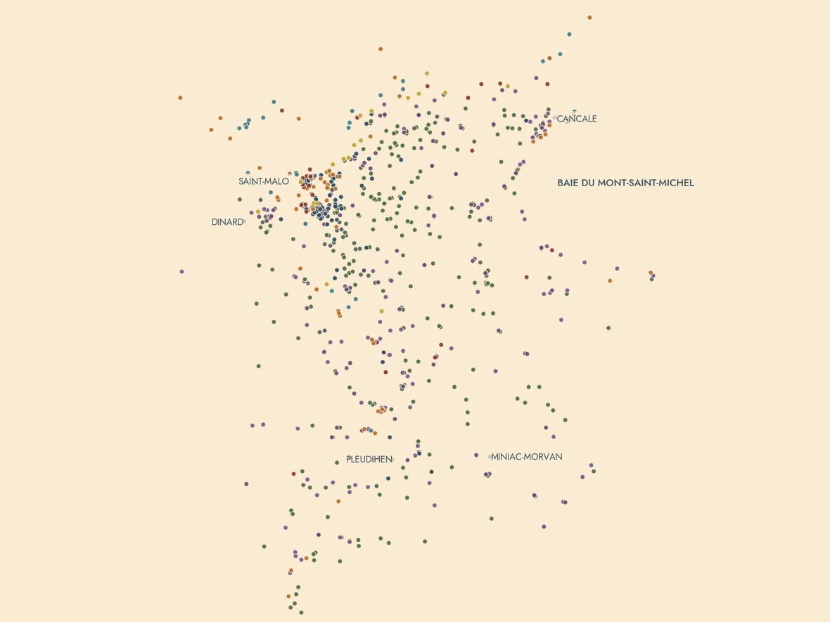
Saint-Malo, the Rance and the Clos-Poulet seen through the pinpoints of La Maplouine: one per note, the colour gives the category, with no base map at all.

Nobody pays to be on it

No advertising. No sponsorship. Wholly independent.


No advertising

No banner, no partner link. You pay once, and the map is yours — kept up to date for good.

No sponsorship

A place is there because it is worth the detour, or it is not there.

Wholly independent

We are not a tourist board, an agency or a hotel, but Malouins taken with the history of their town and set on sharing it whole and unfiltered.

Demonstration map

Free
  • 50 places, five per category
  • The full note for each one
  • Opens in Google Maps
  • French and English
Choose a language

Full map

9 €
  • More than 950 notes: Saint-Malo, the Rance and the Clos-Poulet
  • Cancale, Dinard, Dinan, the Dol marsh, the forts and the islands
  • Updates included, for good
  • French and English
Buy 9 €

Secure payment by Stripe, VAT included. The link reaches you by e-mail straight away.

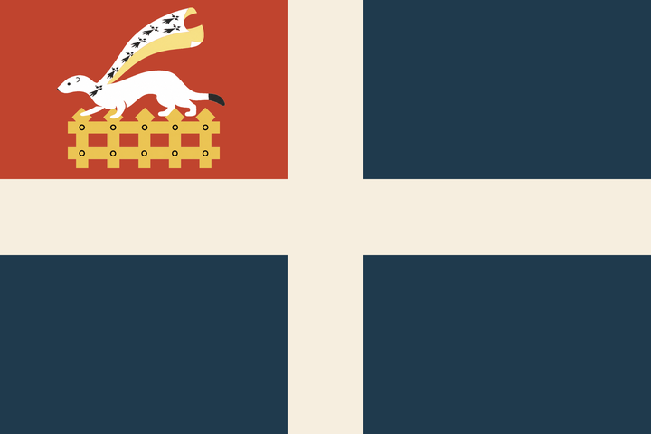
Le drapeau de Saint-Malo : croix blanche sur champ bleu, canton rouge à l'hermine passante et à la herse d'or
The flag of Saint-Malo: a sea flag, born of the merchant navy's blue and white cross and the red of the king's privateers.

Who we are

Compiled by a team of passionate Malouins.


La Maplouine is made by a team of passionate Malouins — as taken with the great history of privateering and discovery as with the small anecdotes, the lives of the inhabitants of every condition, the manor houses, the tides, the rebuilding. Ramparts, forts, churches, manors, mills, islands, beaches, streets and plaques — every aspect of the Saint-Malo country, gathered in one place and read as you go.

The map grows regularly and every update reaches you: buy it once, for life, and it will keep growing.